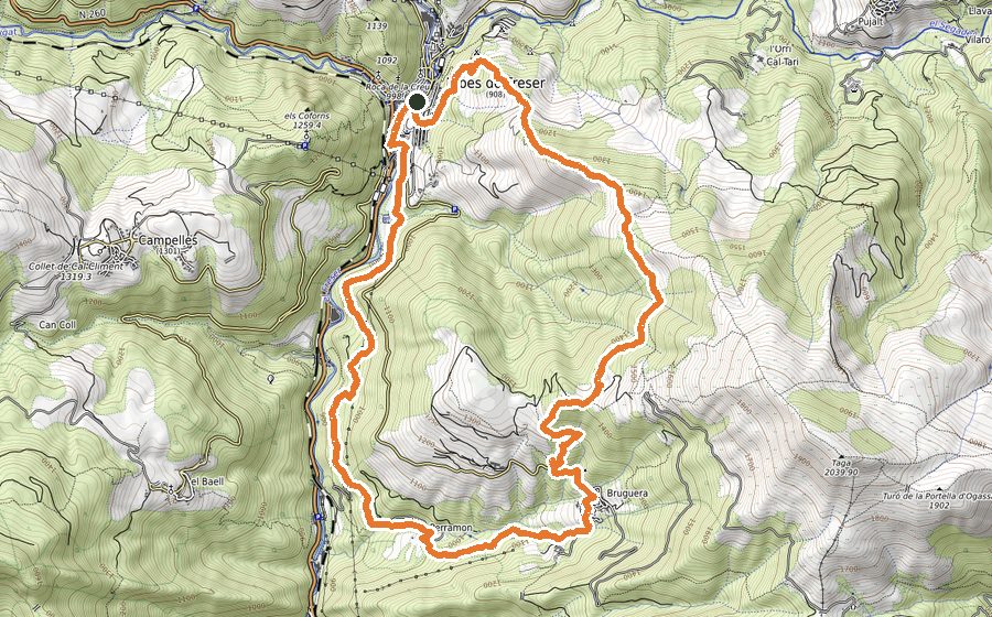
The route
This is a short but entertaining and challenging trail, with different kind of tracks and paths, passing through canals, fields, summits and peaks. The high point of this circuit is the Costa Pubilla summit in Sierra de Montgrony, an astonishing lookout in the Eastern Pyrenees with the Puigmal peak as the centre of attention.
The starting point is in front of the City Hall, in a square-lookout that already gives you a sample of the kind of views that you will find along this route.
Walk across the town until you get to a green water tank. Just after that, take a path that in constant climb will get you to cross the track of Refugio de la Covil (la Covil refuge). Keep walking the grassy path across the forest until you get to the crossing tracks point called Coll d’Erola, a very quiet place where cattle can be seen grazing. Cross the track and keep climbing up along the forest until you come across the next track that should be followed for around 1 kilometer, still surrounded by a dense forest.
Enjoy the amazing views that you will find along that track on the top of the Eastern Pyrenees and continue walking until Coll Roig. Just before this col, divert to the left and go across a field, passing beside a small fort full of history. Going past that, you should get to the Coma Ermada canal, that will bring you to a breathtaking viewpoint at its very end. You are getting now to the high point of the Sierra de Montgrony, in a summit that has 360º panoramic views.
To start descending, come back to the Coll de Coma Ermada and keep walking until you get to the high point 2001m in La Covil. Keep going down by the fields looking for the Refugio de La Covil, a shepherd’s hut that can be used as a shelter if the weather conditions are not good at that stage.
After leaving the shelter, keep going by track for 400m to then take a path on the left that will bring you to Refugio de Pla de Prats in constant down slope. This is a leisure area located at 1500m height that has a water fountain and some picnic tables at your disposal.
The next stretch of the descent is the challenging part. You should beware of remaining in the track as well as avoiding the dense vegetation that covers that narrow path. Keep descending in zigzag and you will come across a refuge track.
From now on the walk should be easier. Move towards Campelles through a forest track of 2 kms (half dirt, half paved) until you get to the cemetery. At this point, leave the paved track and turn left to walk by a dirt trail that will get you back in town through a different entry. After being back in town by a paved path, you just need to retrace your initial steps back to the City Hall square.