The route
A long-distance route you will enjoy non-stop.
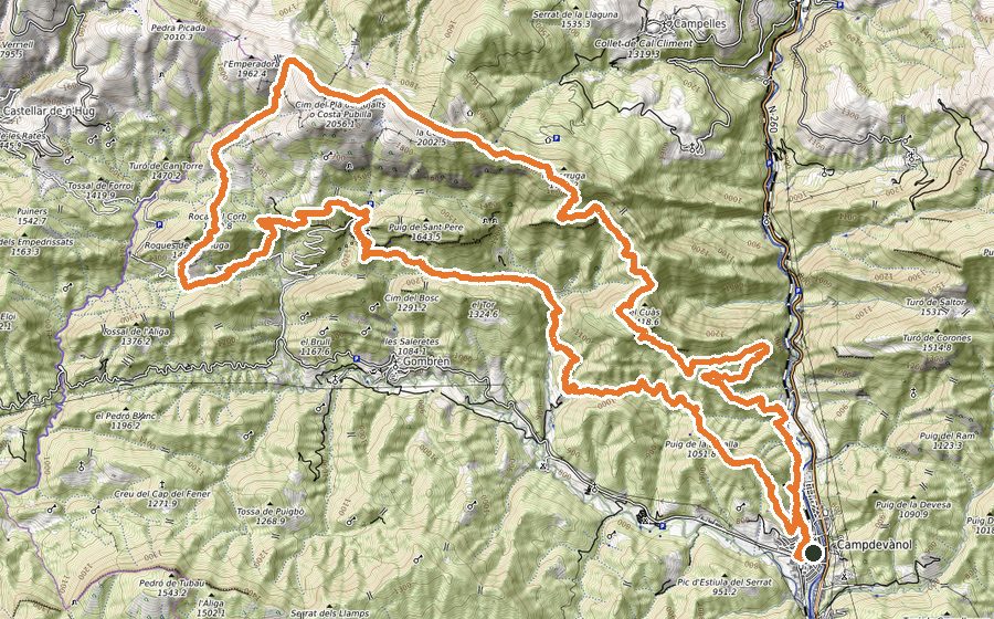
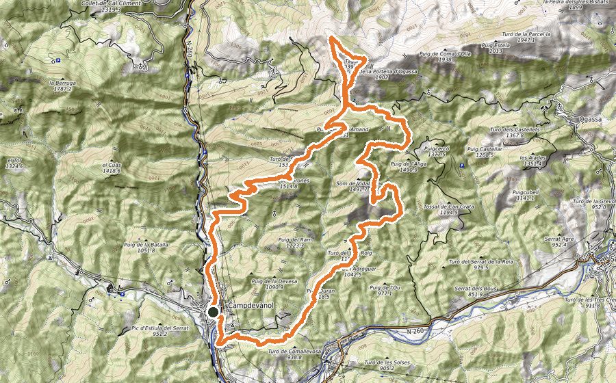
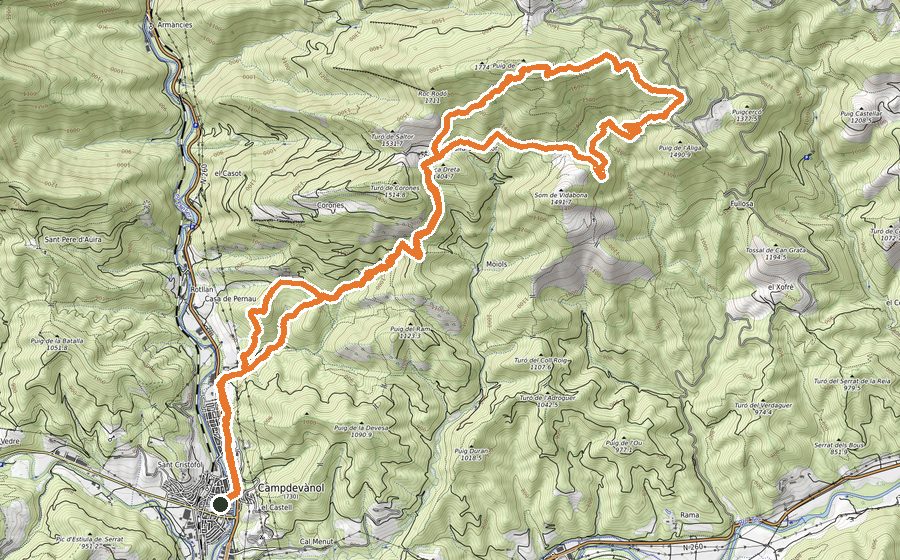
Starting from Campdevànol we pass Sant Marc d’Estiula and head for the highest part of the route, the Rasos de Tubau, going deep into forests and cliffs on the border between the Ripollès and the Berguedà. We return past large farmhouses that are now abandoned, Sant Feliu d’Estiula, the Bassa Gran del Colomer pond and the Serrat de l’Auró.
Essential kit if you are running: backpack with a hydration system of at least 1 litre plus water purification tablets (there are few water points, especially in summer), food, a thermal blanket, mobile phone, and a windproof or waterproof jacket depending on the forecast.
We leave Plaça de la Mainada along the Camí Ral that takes us to Sant Llorenç de Campdevànol, as far as the Font del Querol picnic area. At first we follow the PR-C26 towards the ruins of the old house of La Mosquera. Right there we go down the track to cross the Estiula stream and climb onto the tarmac track, which we follow uphill. From the track we turn right onto a path that takes us below the Casalot house. We do not reach it: below it, in a boggy area, we take a path heading downhill to a disused forest track that leads to the Serradell stream, where we pass right by a waterfall. We have to climb several stretches of forest to reach the track to Sant Quintí de Puigrodó.
Above the meadows of Sant Quintí we take a very steep path (the one on the left) with yellow and red waymarks. We pass the abandoned farmhouse of Can Santmarc and, leaving it on our left, keep climbing to the Hermitage of Sant Marc. We follow the small ridge downhill on a path to the Coll de la Creu de Ginebrar, where we turn right and, about 200 m later, left (fence). From here on we run on forest tracks through beech woods, along the Carena de les Girades, to the Collada de la Palomera, where we turn left to reach a pond and take the path up to the Cingles de Modolar cliffs.
Once past the cliffs we reach the foot of a stream. Here we turn left onto a direct climb that follows the top of the cliffs, with incredible views. We always stay close to the cliff edge (carefully) and the narrow path takes us straight to the Pedró de Tubau. From the Pedró we follow the line of the cliffs towards the Bassa de Corrubí pond and on to the Coll de Faig General, traverse below the Serrat dels Llamps and descend towards Llentes on a path. We cross tracks several times until we reach the main one.
We start a section of forest track that takes us to the uninhabited farmhouses of La Garsa and Les Cases, ending at Sant Feliu d’Estiula (behind one of the buildings there is a small spring with troughs). We go down the track to the Estiula stream track, where we take a shortcut that starts at a sharp left bend, just before a cattle grid, to go down to the stream.
We follow the stream downhill, crossing it, and pass above the Bassa Gran del Colomer pond. After this point we come to a fork and take the path up to the Serrat de l’Auró. At the top we turn left and follow the path gently downhill past Els Emprius to Estiula del Serrat, where we go down a narrow path with a spring, arriving at the Barri de la Creu in Campdevànol.