The route
This is a challenging but rewarding route that will bring you to reach the summit of Sant Amand. In winter season some areas might be frosted, so make sure you are well equipped and be careful specially around the highest spots and when crossing streams. It is the perfect trail for summer because of its large number of shaded areas.
Along the route you will come across some farming areas, so be careful when passing by enclosures and always make sure that you leave the gates closed behind you.
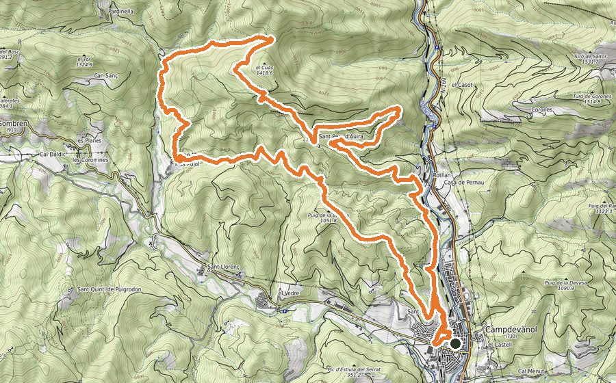
The route starts in Campdevànol, from Plaça de la Mainada and moving towards the City Hall and the sports area. Cross the road by the pedestrians crossing and you will pass by the paddle tennis courts. After that, go across a metallic fence and start walking the path that, in gentle slope, will bring you into the forest.
You will come across a flat forest track and after that you will cautiously pass some enclosures that will lead you to cross the stream Torrent de Sant Martí. Keep climbing a path that becomes a forest track after a while. Following this track you will go past the ruins of Mas de Sant Martí de Baix. Take a path and, after crossing several times a forest track, continue the steady ascent till you meet Collet dels Graus.
From that col, where you will see some sign-posts, continue towards “los graus” turning to the left. Once you pass a rocky path stretch you will get into a leafy beech forest. Follow the enjoyable and shady trail that will lead you to Saltor, an idyllic field at the foot of Sant Amand. Over there you will find too the hermitage and the farmhouse of Saltor.
Go across the field and you will immediately find a footpath on an incline that constantly rises and goes through dense and shady beech forests that will transport you to Compte Arnau times. Leaving behind these forests you will come across a col with a disused trough. Turn left and keep walking that way, passing just beside an impressive millennial beech.
Eventually, you will get to Canal de Sant Amand, where you might need your hands to climb in some parts. If you are going in a group, beware with falling stones. Once you have reached the headwaters of the canal, you will see the Font del Pi and just after that an enclosure. Pass it and at that stage there are just a few meters left to reach the summit and the immense cross that overlooks the astonishing surroundings.
Come down the rocky hill and take the flat trail on your right. It will gradually go downhill and some areas can turn out quite technical, but it is worth because of the stunning views of Sierra Cavallera and Sierra de Milany. Keep descending till the open fields of Coll de la Tuta or Plans de Xirinacs.
Go across the fields to take a path that will bring you around the ruins of Cal Pegot farmhouse. Continue along a colourful beech forest by an easy to follow path, passing some pools on your way. At some point you will come across the GR (Long-distance) and you have to take a sharp turn to the right to keep descending towards Collet del Vent. Just before reaching the col, you could have access to water beside a small pool and behind a couple of stone blocks. where there is water springing up. Once you are in the col, cross the field and you will shortly be back in Saltor.
Once again, get into the beech forest to keep descending, passing by Camino dels Graus, its col, crossing the forest track and passing beside the fountain of Sant Martí Vell. Walk along the track for 500 metres until you find and enclosure on your left. Keep moving straight for another 500 meters, passing by the old quarry, until you meet “la mesa” and the signpost that will indicate you the way to the Ermita de Sant Grau. After this last uphill stretch, take a break and enjoy the amazing views over the Freser and Campdevànol. To continue the descent, follow the narrow but straight path that can be found on the right of the hermitage. Walking that path, that will turn in zig-zag eventually, you will arrive to the fields near to Mas de Can Molí Nou, very close to Campdevànol. Cross the Torrent de Sant Martí and keep retracing your steps back to town. Once again, be careful while crossing the road and make your way along the streets of Campdevànol towards Plaça de la Mainada.