The route
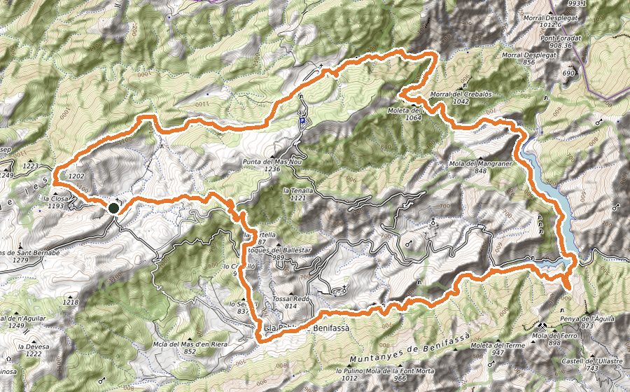
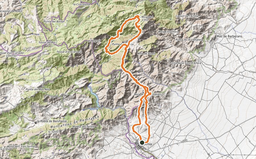
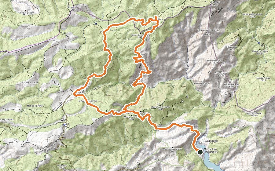
The proposed tour named La Vuelta al Negrell is unique for the nooks of the Parque Natural dels Ports and the Parque Natural de la Tinença.
The route has its starting point at Cueva Ferrins, junction between theTenalla and the ravine la Fou, where we can find a small parking side of the Parque Natural. At the confluence of the two ravines we find a small signpost that guides us towards Pont Foradat. Up to here we follow the Trail touring on the left side of the ravine la Fou almost always uphill. Between spectacular karstic formations we can sight the first goal of the day-route, the Pont Foradat, a geological formation that will leave you flabbergasted. To enter we must continue the marked track by a signpost up to a small climb that will let us access inside it. We will find ourselves right at the limit of the two natural parcs and the two autonomous communities that represents it.
We split the route at the intersection in order to continue the path not so milled to surround the Pont Foradat up the north face and continue down the huge walls of the Mola Aixada direction Portella de la Malladeta. Once we find ourselves here, we continue the Parque Natural dels Ports path, the Cova Roja. We take the path uphill to left and pass above a Steel cable a bit aerial but without any difficulty. We’ll surround the Eastern foothills of Mola Aixada in order to start descend the Cova Roja ravine. Early starting the downhill we can divert and see the cave and drink some fresh water at the fountain that spring under its huge walls.
The route in descend crosses the Tosques ravine and links with the parth of Cova dels Bous. We will continue always climbing again on the left side of the Fou ravine. In a few kilometres we will get to Cova dels Bous, a great viewpoint of the Morral de Catinell where we can enjoy the geology of this Ports’s small place.
The track continues uphill towards Racó dels Cirers, a fully Pyrenean meadow in the middle of the red pine forests, beech and othe bunch of trees. Thereafter we continue a few hundred metres away on the Fou path and we will leave it to continue on the Carrasca Grossa path, where in a few metres we can see this “100 years old tree” and the fresh water fountain that springs at its feets.
We continue the same path always uphill direction Casetes de Cap Gros to link it with GR7. This path crosses all Catalonia from north to south and this time we take the south direction.
We cross al the superior part of the Capatx ravine, Vallcaneres and below the Negrell top, that we leave in order to ascend to this Ports viewpoint. This is where we reached the top of our route and the almost 19 km route.
Next we’ll descend on the track that gives us access to GR7 link to the Font Ferrera shelter, FEEC’s property where we can take a rest or split the route in two and stay overnight.
We get out of the shelter leaving GR7 at pour right to further the PR that will leave us at the Mas del Peraire, where the FUNDEM foundation has a reserve of lora and fauna. There it will be no surprise finding great specimens of Cabra Hispánica, emblem of the Ports.
Once we leave the farmhouses we take a sharp decline that will take us to the Tenalla ravine. Here we can chose an alternative route if we still have enough strenght, going uphill to Salt del Robert, some 400 metres uphill as many as downhill, through a magnificent path. If we decide continuing the path we only must follow the track on left side to get to the Tenalla forestal home and get in an end at the Cova dels Ferrins.