The route
Route to make from spring to autumn. In winter we could find snow in the highest areas, so we must be informed before going.
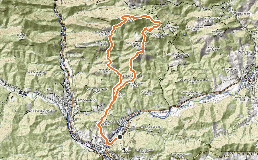
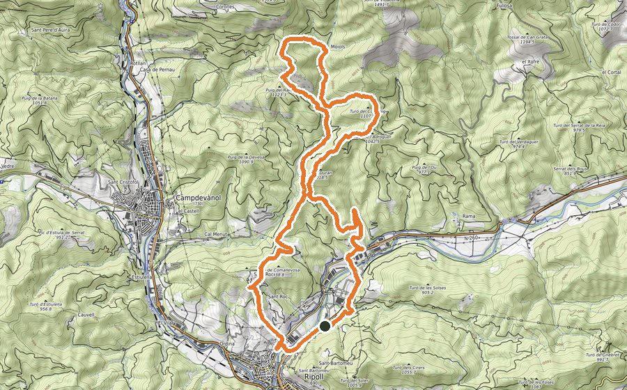
We will start the route in front of Pavelló de la Avellaneda (Centre de Tecnificació Esportiva), from where we will cross the road to make the first meters by the Camí Ral towards the CAT (Tourist Attention Center) and cross the Ter River by a bridge and we follow the streets and go up to the cemetery. In front of the entrance we will find the path that will lead us always in ascent to the hermitage of Sant Roc, a great viewpoint of Ripoll. Here we will start a short descent to the Coll de Comallevosa, where we will enter the path again until we find a signpost. Up to this point, the path is shared with the return stretch.
At the signpost we will take the road to the left, following the path we will reach the Gorg de l’Olla, and continuing along the path, we will reach the Collet dels Graus, and after Sant Julià de Saltor, where we will find a farmhouse and an hermitage. We will turn the farmhouse, respecting the fenced area, and on our right we will find a path, marked in red, that without truce, will lead us to the “Canal de Sant Amand”, a small canal, without any danger, on top of which we will find the Font of Pi.
After the fountain, we will find a wooden pass, on a small landing, and turn left along a path that will lead us to the Pla de la Pena, an impressive viewpoint of Baix Ripollès region. At this point we will begin the descent to Coll de Jou, through a leafy beech forest.
Arrived at Coll de Jou, we will cross the cement road, and always at the left of the cattle fence, we will go uphill through alpine meadow, following the track, looking for small cattle roads, until the grassy edge SW, where we will make the most demanding stretch of the route, to the cross that marks the highest point of it, the Taga, whith its 2040m is also the highest point of the Serra Cavallera, from where we will have spectacular views of almost the entire Eastern Pyrenees. We will descend again to Coll de Jou along the normal route, following yellow markers, and once there, we will go up to the Pla de la Pena, this time in ascent.
Here we will make a turn to the left, and in ascent, we will arrive at the second peak of the day, Sant Amand, whith its 1851m is an authentic viewpoint of a good part of Central Catalonia. We will descend from the cross, and on the right we will begin a long descent, always by path, until the Coll de la Tuta, where we will arrive by the meadow that we will cross following the track, and where we will see, as a reference, a large rock marked with an X in honor of Xirinacs. We continue straight and we will see a pair of indicator poles that will mark us the path to follow until the hermitage of Vidabona, where we will always arrive by road with tendency to descend.
Next to the road we will find a small fountain, not always with water, and we will continue down on a well defined path, following the yellow signs and the track, which after a short stretch, will return us to Coll de Comallevosa, where we will recover the initial section, now up to Sant Roc, and after passing through it again, we will make the last descent that will lead us to the starting point, the Pavello de la Avellaneda.