The route
Get your ranking on this route with the Open Trail Races app
SERRA DE BUSA
This route is designed for middle-distance training sessions that look for good elevation gain and varied terrain. It offers superb panoramic views, as a large part of it runs along the ridge of the Serra de Busa.
As an option, you can visit the Presó de Busa (Busa Prison) by following the signs at the Capolatell. The Capolatell is a hill surrounded by vertical walls 100 m high and reachable only by a bridge; once the bridge was removed, there was no way out. For this reason it was used during the Peninsular War (1808-1814) as a prison for soldiers of Napoleon’s army.
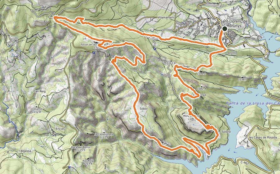
The start is on an embankment beside the C-462 road, next to Cases de Posada, where you can park easily. We set off from the signpost marked Busa. Right from the start we climb on an easy, well-marked path, follow the power line and come out onto a concrete track. We follow it for only 100 metres and turn right onto a narrow path marked with cairns that runs through the forest without any risk of getting lost; the slope is now quite steep. We reach a level spot with a sign for the Ruta de Busa path (1032 m), which we follow, turning left straight away with the Capolatell in the background. Now we go along an easy, flat path to km 3, where you can optionally turn right to join the return track after just over a kilometre of climbing, shortening the route to only 9 km in total. We keep left instead and climb to the Coll de Trasserra (km 3.7, 1104 m), where we turn right, and at the next fork we also keep right. On our right we can see the hills of La Llebre (1478 m) and El Cogul (1526 m), the highest point of the route. At km 5.3 there is another option to shorten the route by 4.6 km, facing a steep climb up the Canal de Casa Vila. We keep the same direction all the time, still inside the forest. The views close by to the north are now spectacular and very typical of this area, with its sharp ridges and hills: Serra dels Bastets, Roques del Capità, Serra and Tossal de la Viuda, Tossal Gran. We continue on a comfortable, wide track through a beech forest and at km 7.1 take the path on the right, which climbs gently to the turning point of the route, km 7.5, a man-made gap between two rock walls. Once through the gap the landscape changes dramatically, with the Pla de Busa and its pastures at our feet, and farmhouses such as La Bartolina, Ca l’Artiller and El Rial de Busa. From here we return along the northern cliff of Busa, wide and straightforward, but we must be careful not to get too close to the edge, where a fall would be fatal. We soon reach the Cavall Bernat (1403 m), continue over the Serrat de la Llebre, pass the Coll de Casa Vila (where the Canal de Casa Vila shortcut mentioned earlier comes out) and finally finish climbing at the summit of El Cogul (1526 m), the highest point of the route, topped by a mast with flags. We continue past La Llebre (1478 m) to the Capolat viewpoint. We are now at km 11.6, and from here you can go and see the Presó de Busa and come back to this point, adding 2 km and 80 m of climbing. We continue on a narrow path heading south, losing height over rocky ground, and reach a flat area with a wide track, which we follow to the right and leave 70 metres later to enter another narrow path marked in yellow. We approach the walls of the Capolat and follow them on flat ground for about 200 metres, passing through a tunnel formed by leaning rocks. We move away from the walls, turning left, and a gentle 600-metre descent takes us to the Pla de Capdevila de Llobeta, with the ruins of some old farmhouses and their chapel. We continue along the path, with views over the Llosa del Cavall reservoir, and in about a kilometre we are back at the start.