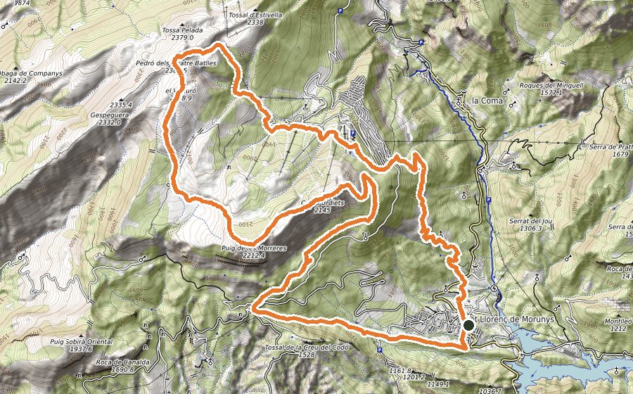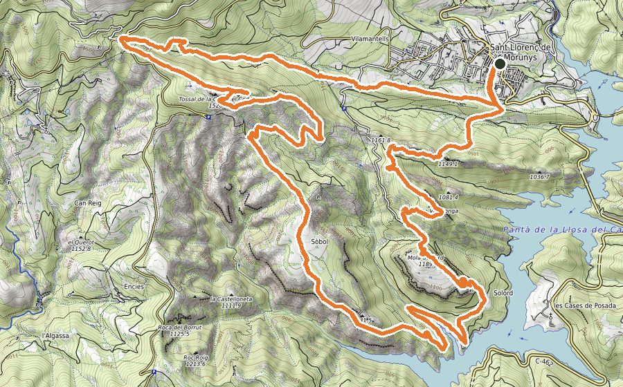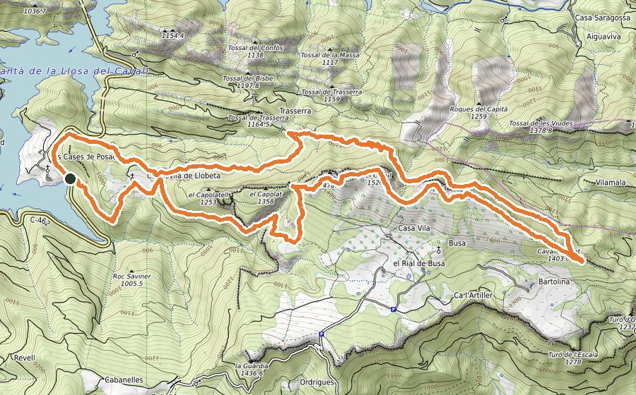
The route
Get your ranking on this route with the Open Trail Races app
INTEGRAL DEL VERD
Sant Llorenç de Morunys is the centre of outdoor sport in the Vall de Lord. The valley is well equipped for you to do as much activity as you like, alone, with friends or with your family. You will find all the information you need on its website and at the information office.
The track we propose links three existing hiking routes, so it is easy to follow if you pay attention to the signs and, of course, use your GPS with the track we provide.
It is a varied, tough route with short technical sections where you must go very carefully, but on the whole it is very runnable provided you are in very good physical shape.
It can be divided into two parts: the lower part, up to the level of La Coma, which is less demanding, and the upper part along the Serra del Verd, with steep slopes of more than 40% in many places.
We set off from the Vall de Lord Tourist Office along Carrer de les Comes, continue along Carrer Prat Tomàs and after about 100 metres find the track on the right with the GR-1 waymarks. We soon reach a wooden bridge over the river Cardener. We follow the track, gaining height up to the chapel of Sant Lleïr de Casavella. From here we alternate between paths and tracks that let us run freely, pass the Coll de Santa Creu and can visit, on the left, the chapel of Santa Creu del Roser (the first way out if anything goes wrong: head towards La Pedra and, following the track, you will rejoin the descent track back to the start).
We continue along the Camí de les Valls de la Pedra and go down to cross the river Mosoll, reach the ruins of El Minguell, pass them on the right and continue on the level to a signpost, where we have the second way out by following the direction of La Coma (about two km until you reach the return track to the start).
This is where the second, upper part mentioned at the beginning starts, and we follow the signs to Cap del Verd. This is a good moment to recharge, because from here we will gain 1000 metres of elevation in 5 km. On the way to the summit we pass the Borda del Pujol, enjoy the views of Roca Mira, and then from the Prat de les Saleres, where in season we will find cows grazing, we can (optionally) go to the cool Font d’Urdet spring and come back about 300 metres to the meadow, where we keep our height to cross a small alpine wood that takes us to the Coll de Belitres. We turn left up a grassy slope and reach the summit of Cap del Verd (2284 m), the highest point of the route, with spectacular views of the Serra d’Ensija, Pedraforca and the whole Vall de Lord.
Following the track clearly down towards the valley, we find the signs for the Verd scree. The first section, about 100 metres, is somewhat dangerous and calls for great care; after that we let ourselves go down the scree, paying close attention, because after about 350 metres we must turn right to find, shortly after, the start of the narrow path that enters the forest. If we miss it, we can carry on to the bottom of the scree, where a path on the right takes us back to the track.
The path takes us over the Coll de Veís and the Coll de Virolet to the track at the Coll dels Ordinaris, which leads to the Coll de Coma Pregona. On the continuous descent we cross the track several times and must watch for the shortcuts so as not to miss them. We reach La Coma along the side of the road and cross its well-kept village centre, leaving it behind when we find some steps. From here on it is all wide tracks running alongside the river Cardener, which is first on our right and then on our left after a short stretch of road. We follow the signs to the Font de la Puda spring, whose name (‘the stinking spring’) we will soon understand, and just before reaching it we cross the river by the bridge. Further down we pass the Morunys campsite and follow the track to the bottom of the Camí de les 40 hores, where we cross a stream and shortly after, climbing, arrive back in Sant Llorenç de Morunys.