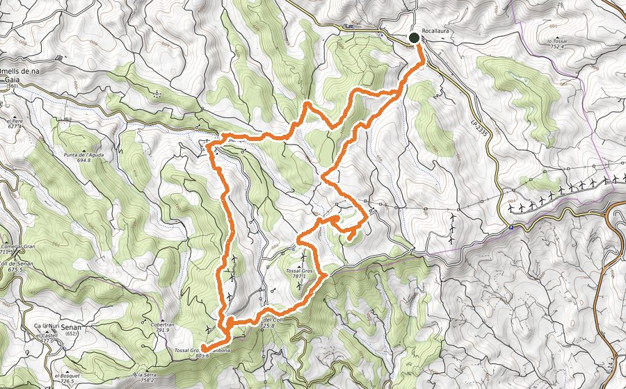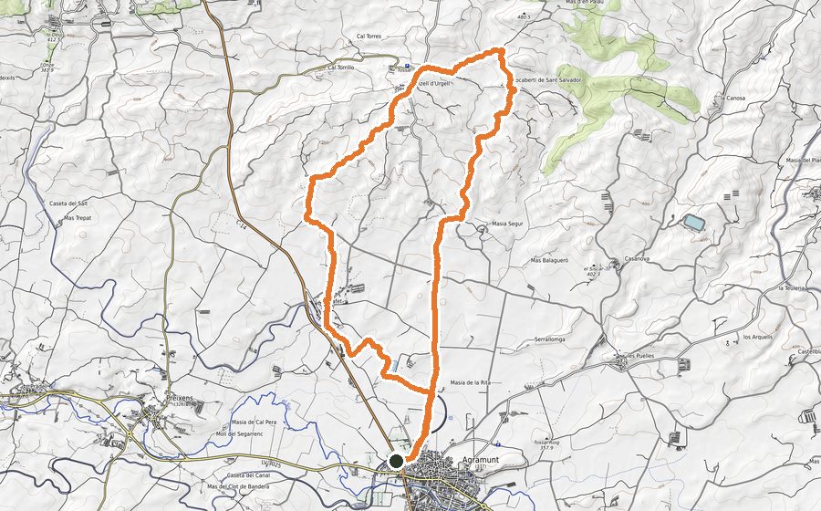
The route
This is a route that will take us from town to town, all of them full of history, and will make us feel the peace of the Urgell region and the splendour of the rainfed crops that will surround us all the time. Vines, olive trees, almond trees and cereals will be practically the only witnesses of our passage. It will be a different visual experience depending on the season of the year in which we do it, the silence, only disturbed by our footprints, will always be the same. The entire route can be done by mountain bike
We will run on well-known paths, either to be part of the Cistercian Route and the Camino de Santiago. We will also visit part of the Corb Valley and we will be able to visit the towns of Rocafort de Vallbona, El Vilet, Maldà, Belianes, Sant Martí de Maldà and we will finish the route where we started it, Vallbona de les Monges where we can take the opportunity to walk slowly through its streets and visit the Cistercian Monastery of Sta. Maria de Vallbona.
This route is very good for training sessions where we are looking for easy unpaved terrain and for running at high speeds on a smooth and constant incline. In this route the false plan will be the dominant trend. It is an excellent training to gain that much-needed speed in some sections of mountain races, but also for asphalt runners, both half marathon and marathon, and who want to improve or test their power in the race by training in an environment natural and away from the asphalt and crowds. The less gentle climbs are at the beginning and at the end (it will be necessary to have saved a little for this last climb since it can be long depending on how we get to it). The entire route is by dirt track except for some short paved sections. It is very easy to follow with a GPS watch, therefore it can be very good for anyone who wants to learn to navigate with these devices.
We will leave the parking lot in front of the municipal swimming pool of Vallbona de les Monges, we will cross the town passing in front of the Monastery and we will go up looking for the road to cross it and immediately find the GR-3 (red and white paint marks) and the signpost for Rocafort de Vallbona, the first destination on the route. We will progressively ascend for 2.5 km on a wide track to Coll de l’Olla, which, located at an altitude of 590 m, will be the highest point of the entire route. From there we will begin a descent through the Vedats, we will surround the Tossal del Tau, the Tossal del Roc and at km 7 we will be in Rocafort de Vallbona, where the Castle and the Church of the Transfiguration are (with good panoramic views of area). We will continue to the left along a 400 m section of road and immediately on the left we will take the track. We will follow indications of Vilet, which in slight but constant ascents and descents, which will break our rhythm, will leave us 2 km later at Vilet, km 9 of the route. In Vilet we will cross the town passing in front of the Church of Santa María del Vilet. We will start a loop here that will return us to this same point 11 km later, therefore, if we do not have the day, it will be a good time to return and do only 15 of the 26 km. We will skirt the town along the road for a few meters and then we will take the track that opens on the left. We will follow indications towards Maldà bordering by fields of cereals and olive trees. We will enter Maldà, km 12, through Calle de Jesús, and although the route continues along this street until we leave the town, we can optionally take a walk to see the Castle and the Romanesque Church of San Pedro. We will leave the town continuing straight on Calle de Jesús, we will cross the C-331 with caution and an extensive plain of cereal and olive crops will open before us with the town of Belianes in the background. We will follow the very flat track to Belianes, we will go around the town, km 14.5, and we will take the track to the right that will lead us to the Corb river that we will border on the left and cross a few meters later. Shortly after, we will find the Molí de la Torre (belonging to the Baronía de Maldà, 11th-12th centuries) where the millstones are still preserved. We will follow the track that will turn our course 180º widely and will take us to the Raft of the Tower, where we can easily observe ducks and other birds. Here we will start the long climb back, about 10 km that will gradually wear us down. Now we will continue along the track parallel to the Acequia de Montpàs, we will pass over the Segarra-Garrigues Canal and when we reach a small dam we will turn left to go decidedly up and straight to Sant Martí de Maldà, km 20, which we will cross, continuing along the Vilet path, but not before having passed through the Plaza de la Iglesia and having been able to observe rural life magnified in a large mural that occupies the side facade of two houses. We will go away from town passing by a bridge over the Corb river and we will go around El Vilet. The track will always lead us up and in practically the same direction, indications of Vallbona, first bordering La Collada, a very beautiful corner, and the Plan de Sileta, with the El Guixà estate. At km 25.7 we will finish the climb and descend quickly along the track that in 1 km will leave us again in the parking lot of the swimming pool, this time crossing Esportell street to shorten the route. Now we will have time to visit this interesting town, full of history, and its Royal Monastery of Santa María de Vallbona. If we like cinema, we will not miss visiting the Cinema Museum Space (Josep Maria de Queraltó collection).
Area with little mobile coverage, take the track already downloaded and this page preloaded if you want to consult during the route.
The towns
- Vallbona de les Monges
- Rocafort de Vallbona
- Maldà
- Belianes
- Sant Martí de Maldà
- MTB & trekking in Urgell